
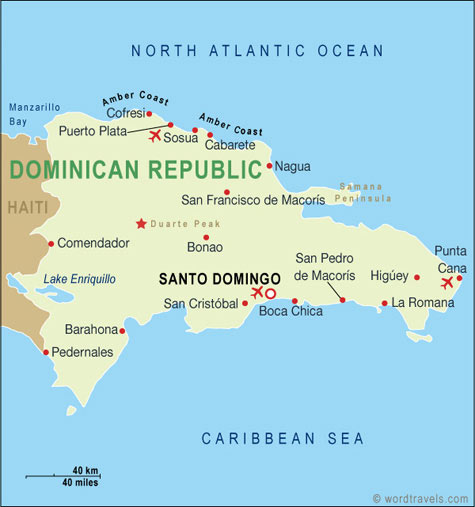
Puerto Plata Plan
Naviguer Puerto Plata plan, Puerto Plata plan de ville, images satellite Puerto Plata, Puerto Plata plan des villes, carte politique Puerto Plata, itinéraires routiers et cartes de circulation.
Plongez-vous à Punta Cana Découvrez les 10 meilleures expériences
Veuillez vous abonner à la chaîne "World Guide" sur Youtube à youtube.com/c/WorldGuide
Puerto Plata Plan & Puerto Plata Images Satellitaires
porto Plata plan
Cartes connexes Puerto Plata et Puerto Plata d'images satellites
PORTO PLATA PLAN
Puerto Plata Google Carte, Vues de la Rue, Directions des Cartes, Images Satellites
MondeCarte.com offre une collection de Puerto Plata carte, google map, Puerto Plata atlas, politique, physique, vue satellite, infos pays, carte des villes et plus carte de Puerto Plata.
Republique Dominicaine Carte des plus Grandes Villes par Population
Puerto Plata Plan Santo Domingo Plan Punta Cana Plan© MondeCarte.com - 2014 - 2026. Tous les droits sont réservés. Politique de Confidentialité | Avertissement